Olivia Krüger · 12 September 2026
The Evolution of Neighborhood Connection Tools in Modern Urban Planning
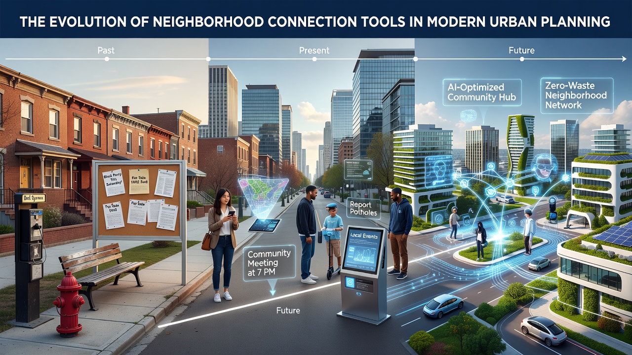
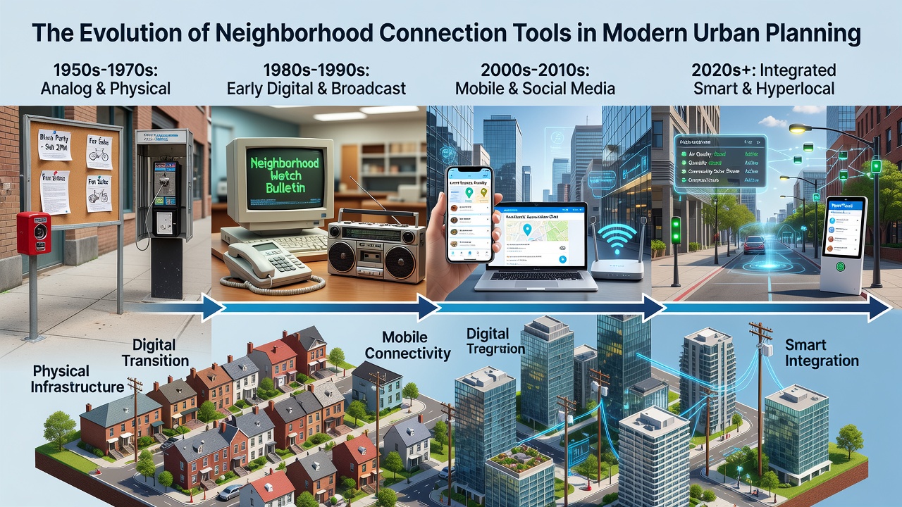
Neighborhood connection tools have shifted from physical bulletin boards and town hall meetings in earlier decades to integrated digital platforms that facilitate real-time resident interactions and urban data collection, and this progression reflects broader changes in how cities manage community input alongside infrastructure development. Researchers have documented the transition through case studies in multiple regions where planners combined traditional outreach methods with emerging technologies to address population density and social isolation patterns.
Early Methods and Their Role in City Design
Physical notice boards, community newsletters, and scheduled public forums formed the backbone of neighborhood engagement before widespread internet access, while city planners relied on these channels to gather feedback on zoning proposals and park developments. Data from government archives shows that municipalities in North America and Europe used printed materials and door-to-door surveys through the 1980s and 1990s to map resident concerns about traffic and housing, and these approaches produced qualitative records that influenced master plans in growing suburbs. Observers note that such tools often reached limited audiences due to distribution constraints, yet they established precedents for structured dialogue between officials and local groups.
Digital Platforms Enter the Scene
Internet forums and early email lists began appearing in the late 1990s and early 2000s as cities experimented with online portals for project updates, and these systems allowed residents to submit comments asynchronously rather than attending fixed meetings. Studies from academic institutions indicate that adoption rates climbed steadily as broadband expanded, with planners in cities like Toronto and Melbourne integrating basic web forms into their consultation processes by the mid-2000s. The introduction of location-based social networks further accelerated this shift, since users could tag specific streets or blocks when reporting issues such as potholes or noise complaints, and this granular input helped transportation departments prioritize repairs more efficiently.
Integration with Smart City Infrastructure
By the 2010s, dedicated neighborhood apps combined mapping features wth push notifications, enabling residents to coordinate events or share resources while also feeding anonymized usage data back to planning agencies. According to OECD urban development reports, several European and Asian municipalities began linking these platforms to sensor networks that tracked foot traffic and public space utilization, and this combination supported evidence-based decisions on lighting upgrades and transit routes. In September 2026, upcoming updates to municipal data standards are expected to expand these linkages, allowing planners to correlate community app activity with environmental metrics such as air quality readings.
Take the example of a mid-sized Canadian city that deployed a custom portal in 2018, where residents logged participation in local clean-up drives and suggested improvements to bike lanes, and city analysts later cross-referenced those logs with traffic volume statistics to adjust infrastructure budgets. Researchers discovered that neighborhoods with higher app engagement reported faster response times from public works departments, although participation varied across demographic groups and required targeted outreach campaigns to maintain balance.
Data-Driven Planning and Community Metrics
Modern tools now incorporate analytics dashboards that visualize participation trends, sentiment analysis from posted comments, and heat maps of reported issues, and these features help urban planners identify underserved areas without relying solely on periodic surveys. Figures from research institutions reveal that cities using combined digital and physical engagement methods achieve broader geographic coverage in their consultation records, since online options accommodate shift workers and caregivers who cannot attend evening sessions. Yet the same datasets also highlight gaps where language barriers or limited device access reduce representation, prompting some administrations to maintain hybrid models that include printed summaries distributed at libraries and community centers.
One study revealed that integration of neighborhood connection tools with geographic information systems allowed planners to simulate the effects of proposed developments on local social networks, and this capability proved useful during post-pandemic recovery efforts when authorities sought to strengthen community ties in high-density districts. Observers note that such simulations draw on aggregated location data rather than individual identifiers, which aligns with privacy regulations in multiple jurisdictions and supports long-term trend analysis.
Current Trends and Future Outlook
Artificial intelligence features have started appearing in select platforms, where algorithms suggest neighbor matches based on shared interests or route patterns, and early pilots in Australian and Scandinavian cities have tested these functions for organizing volunteer networks around public space maintenance. Data indicates that these additions increase repeat usage rates when paired with clear opt-in controls, while planners continue to evaluate their impact on overall community cohesion metrics tracked through annual resident surveys. External links to authoritative sources such as UN-Habitat urban planning resources provide comparative international benchmarks that help standardize evaluation frameworks across different regulatory environments.
Conclusion
The progression of neighborhood connection tools demonstrates a consistent pattern of layering new technologies onto established practices, and this approach has enabled urban planners to incorporate wider resident perspectives into infrastructure decisions while addressing practical challenges of access and representation. Continued refinement of these systems through 2026 and beyond will depend on alignment between technological capabilities, regulatory requirements, and documented community needs across varied city contexts.